Mostrar el registro sencillo del ítem
dc.contributor.author
Gomez, Maria Eugenia

dc.contributor.author
del Cogliano, Daniel Hector

dc.contributor.author
Lahitte, Cecilia
dc.contributor.author
Rodriguez Tello, Mauricio N.
dc.date.available
2020-02-20T21:13:32Z
dc.date.issued
2013-12
dc.identifier.citation
Gomez, Maria Eugenia; del Cogliano, Daniel Hector; Lahitte, Cecilia; Rodriguez Tello, Mauricio N.; Análisis de la performance de tres servicios de posicionamiento GPS online en Argentina; Asociación Argentina de Geodestas y Geofísicos; Geoacta; 38; 2; 12-2013; 95-106
dc.identifier.issn
0326-7237
dc.identifier.uri
http://hdl.handle.net/11336/98208
dc.description.abstract
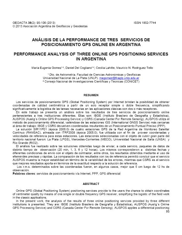
Los servicios de posicionamiento GPS (Global Positioning System) por Internet brindan la posibilidad de obtener coordenadas de calidad centimétrica a partir de un solo receptor simple o doble frecuencia, simplificando significativamente la logística de las tareas necesarias en las aplicaciones clásicas con dos o más receptores. En este trabajo se presenta un análisis sobre los resultados de tres servicios de posicionamiento online pertenecientes a tres instituciones diferentes. Ellas son: IBGE (Instituto Brasilero de Geografía y Estadística), AUSPOS (Auslig´s Online GPS Processing Service) y CSRS (Canada Center For Remote Sensing). AUSPOS utiliza el método de posicionamiento diferencial, valiéndose de las estaciones IGS (International GNSS Service) más cercanas al área de trabajo; IBGE y CSRS devuelven coordenadas resultantes de un Posicionamiento Puntual Preciso (PPP). La solución SIR11P01 (época 2005.0) de cuatro estaciones GPS de la Red Argentina de Monitoreo Satelital Continuo (RAMSAC), alineada con ITRF2008 (época 2005.0), fue utilizada con el fin de proveer coordenadas y velocidades de referencia para estas estaciones. Las estaciones seleccionadas con el objeto de cubrir gran parte del territorio nacional fueron: La Plata (LPGS), Mercedes-Corrientes (MECO), Universidad Nacional de Salta (UNSA) y Río Grande (RIO2). El análisis fue realizado sobre las soluciones obtenidas luego de enviar, a cada servicio, paquetes de datos de distinto tiempo de observación (20 min, 1, 3, 6 y 12 horas). Los mismos correspondieron a distintas fechas y diferentes condiciones de envío con el objeto de contrastar, entre otros, los resultados obtenidos mediante el uso de efemérides precisas y rápidas. La comparación de los resultados con los de referencia permitió concluir que el servicio AUSPOS muestra la mayor estabilidad en término de la variabilidad de los errores, mientras que CSRS es el servicio que mejores resultados aporta en términos de la exactitud respecto a la solución de referencia. Los r.m.s. determinados sobre las coordenadas fueron, en algunos casos, mejor que 5 cm luego de 12 hs de observación.
dc.description.abstract
Online GPS(Global Positioning System)positioning services provide to theusersthe chance to obtain coordinates of centimeter quality by means ofone single or double frequencyGPS receiver, simplifying the logisticof the field workin the classic applications.In the present work, the analysis of the results of three online positioning servicesprovided by three different institutionsispresented. They are: IBGE (Instituto Brasilero de Geografía y Estadística), AUSPOS (Auslig ́s Online GPS Processing Service) and CSRS (Canada Center For Remote Sensing).AUSPOS applies a differential positioning method, using theclosestIGS(International GNSS Service)stations; IBGEand CSRScoordinates are the result of Precise Point Positioning (PPP).The solution SIR11P01 (epoch 2005.0, Sanchez y Seitz, 2011), aligned to ITRF 2008(epoch 2005.0),corresponding to 4 GPS permanent stations of Red Argentina de Monitoreo Satelital Continuo (RAMSAC)was used in order to provide reference coordinates and velocities to these stations.The stations selectedin orderto cover a significant part of the country were:La Plata (LPGS),Mercedes-Corrientes (MECO),National University of Salta (UNSA) and Rio Grande (RIO2).The analysis was performed on the solutionsobtained after sendingdata packets with different observation timespan(20 min, 1, 3, 6 and 12 hours)to each service. They were sent in different epochs and under different conditions tocontrast the results obtained due tothe use of rapid and precise ephemeris, among others. The comparison of the results allowed us toconcludethat AUSPOS shows greater stability in terms of the variability of errors, while CSRS is the service that providesbetter results in terms of accuracy. The r.m.s. determined on the coordinateswere,in some cases, better than 5 cm after 12 hours of observation.
dc.format
application/pdf
dc.language.iso
spa
dc.publisher
Asociación Argentina de Geodestas y Geofísicos
dc.rights
info:eu-repo/semantics/openAccess
dc.rights.uri
https://creativecommons.org/licenses/by-nc/2.5/ar/
dc.subject
Servicios de posicionamiento vía Internet
dc.subject
PPP
dc.subject
GPS diferencial
dc.subject.classification
Geociencias multidisciplinaria

dc.subject.classification
Ciencias de la Tierra y relacionadas con el Medio Ambiente

dc.subject.classification
CIENCIAS NATURALES Y EXACTAS

dc.title
Análisis de la performance de tres servicios de posicionamiento GPS online en Argentina
dc.title
Performance analysis of three online GPS positioning services in Argentina
dc.type
info:eu-repo/semantics/article
dc.type
info:ar-repo/semantics/artículo
dc.type
info:eu-repo/semantics/publishedVersion
dc.date.updated
2020-01-22T19:52:47Z
dc.identifier.eissn
1852-7744
dc.journal.volume
38
dc.journal.number
2
dc.journal.pagination
95-106
dc.journal.pais
Argentina

dc.journal.ciudad
Ciudad Autónoma de Buenos Aires
dc.description.fil
Fil: Gomez, Maria Eugenia. Consejo Nacional de Investigaciones Científicas y Técnicas. Centro Científico Tecnológico Conicet - La Plata; Argentina. Universidad Nacional de La Plata. Facultad de Ciencias Astronómicas y Geofísicas; Argentina
dc.description.fil
Fil: del Cogliano, Daniel Hector. Consejo Nacional de Investigaciones Científicas y Técnicas. Centro Científico Tecnológico Conicet - La Plata; Argentina. Universidad Nacional de La Plata. Facultad de Ciencias Astronómicas y Geofísicas; Argentina
dc.description.fil
Fil: Lahitte, Cecilia. Universidad Nacional de La Plata. Facultad de Ingeniería; Argentina
dc.description.fil
Fil: Rodriguez Tello, Mauricio N.. Universidad Nacional de La Plata. Facultad de Ingeniería; Argentina
dc.journal.title
Geoacta
dc.relation.alternativeid
info:eu-repo/semantics/altIdentifier/url/http://ref.scielo.org/9rs44w
dc.relation.alternativeid
info:eu-repo/semantics/altIdentifier/url/http://ppct.caicyt.gov.ar/index.php/geoacta/article/view/1953
Archivos asociados
