Mostrar el registro sencillo del ítem
dc.contributor.author
Pereira, Javier Adolfo

dc.contributor.author
Varela, Diego Martin

dc.contributor.author
Scarpa, Leonardo Javier

dc.contributor.author
Frutos, Antonio Esteban

dc.contributor.author
Fracassi, Natalia Gabriela

dc.contributor.author
Lartigau, Bernardo V.
dc.contributor.author
Piña, Carlos Ignacio

dc.date.available
2023-08-10T14:58:03Z
dc.date.issued
2022-06
dc.identifier.citation
Pereira, Javier Adolfo; Varela, Diego Martin; Scarpa, Leonardo Javier; Frutos, Antonio Esteban; Fracassi, Natalia Gabriela; et al.; Unmanned aerial vehicle surveys reveal unexpectedly high density of a threatened deer in a plantation forestry landscape; Cambridge University Press; Oryx; 57; 1; 6-2022; 89-97
dc.identifier.issn
0030-6053
dc.identifier.uri
http://hdl.handle.net/11336/207831
dc.description.abstract
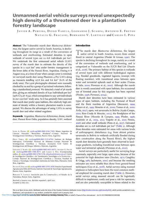
The Vulnerable marsh deer Blastocerus dichotomus, the largest native cervid in South America, is declining throughout its range as a result of the conversion of wetlands and overhunting. Estimated densities in open wetlands of several types are 0.1-6.8 individuals per km2. We undertook the first unmanned aerial vehicle (UAV) survey of the marsh deer to estimate the density of this species in a 113.6 km2 area under forestry management in the lower delta of the Paraná River, Argentina. During 6-8 August 2019, at a time of year when canopy cover is minimal, we surveyed marsh deer using Phantom 4 Pro UAVs along 94 transects totalling 127.8 km and 8.6 km2 (8.1% of the study area). The 5,506 photographs obtained were manually checked by us and by a group of 39 trained volunteers, following a standardized protocol. We detected a total of 58 marsh deer, giving an estimated density of 6.90 individuals per km2 (95% CI 5.26-8.54), which extrapolates to 559-908 individuals in our 113.6 km2 study area. As it has generally been assumed that marsh deer prefer open habitats, this relatively high estimate of density within a forestry plantation matrix is unexpected. We discuss the advantages of using UAVs to survey marsh deer and other related ungulates.
dc.format
application/pdf
dc.language.iso
eng
dc.publisher
Cambridge University Press

dc.rights
info:eu-repo/semantics/openAccess
dc.rights.uri
https://creativecommons.org/licenses/by-nc-sa/2.5/ar/
dc.subject
ARGENTINA
dc.subject
BLASTOCERUS DICHOTOMUS
dc.subject
DRONE
dc.subject
MARSH DEER
dc.subject
PARANÁ RIVER DELTA
dc.subject
POPULATION DENSITY
dc.subject
UAV
dc.subject
WETLAND
dc.subject.classification
Conservación de la Biodiversidad

dc.subject.classification
Ciencias Biológicas

dc.subject.classification
CIENCIAS NATURALES Y EXACTAS

dc.title
Unmanned aerial vehicle surveys reveal unexpectedly high density of a threatened deer in a plantation forestry landscape
dc.type
info:eu-repo/semantics/article
dc.type
info:ar-repo/semantics/artículo
dc.type
info:eu-repo/semantics/publishedVersion
dc.date.updated
2023-07-06T22:42:36Z
dc.journal.volume
57
dc.journal.number
1
dc.journal.pagination
89-97
dc.journal.pais
Reino Unido

dc.journal.ciudad
Cambridge
dc.description.fil
Fil: Pereira, Javier Adolfo. Consejo Nacional de Investigaciones Científicas y Técnicas. Oficina de Coordinación Administrativa Parque Centenario. Museo Argentino de Ciencias Naturales "Bernardino Rivadavia"; Argentina
dc.description.fil
Fil: Varela, Diego Martin. Consejo Nacional de Investigaciones Científicas y Técnicas. Centro Científico Tecnológico Conicet - Nordeste. Instituto de Biología Subtropical. Universidad Nacional de Misiones. Instituto de Biología Subtropical; Argentina
dc.description.fil
Fil: Scarpa, Leonardo Javier. Provincia de Entre Ríos. Centro de Investigaciones Científicas y Transferencia de Tecnología a la Producción. Universidad Autónoma de Entre Ríos. Centro de Investigaciones Científicas y Transferencia de Tecnología a la Producción. Consejo Nacional de Investigaciones Científicas y Técnicas. Centro Científico Tecnológico Conicet - Santa Fe. Centro de Investigaciones Científicas y Transferencia de Tecnología a la Producción; Argentina
dc.description.fil
Fil: Frutos, Antonio Esteban. Provincia de Entre Ríos. Centro de Investigaciones Científicas y Transferencia de Tecnología a la Producción. Universidad Autónoma de Entre Ríos. Centro de Investigaciones Científicas y Transferencia de Tecnología a la Producción. Consejo Nacional de Investigaciones Científicas y Técnicas. Centro Científico Tecnológico Conicet - Santa Fe. Centro de Investigaciones Científicas y Transferencia de Tecnología a la Producción; Argentina
dc.description.fil
Fil: Fracassi, Natalia Gabriela. Instituto Nacional de Tecnología Agropecuaria; Argentina
dc.description.fil
Fil: Lartigau, Bernardo V.. Instituto Nacional de Tecnología Agropecuaria; Argentina
dc.description.fil
Fil: Piña, Carlos Ignacio. Provincia de Entre Ríos. Centro de Investigaciones Científicas y Transferencia de Tecnología a la Producción. Universidad Autónoma de Entre Ríos. Centro de Investigaciones Científicas y Transferencia de Tecnología a la Producción. Consejo Nacional de Investigaciones Científicas y Técnicas. Centro Científico Tecnológico Conicet - Santa Fe. Centro de Investigaciones Científicas y Transferencia de Tecnología a la Producción; Argentina
dc.journal.title
Oryx

dc.relation.alternativeid
info:eu-repo/semantics/altIdentifier/url/https://www.cambridge.org/core/journals/oryx/article/unmanned-aerial-vehicle-surveys-reveal-unexpectedly-high-density-of-a-threatened-deer-in-a-plantation-forestry-landscape/7AA8700F2DE032C47654C2B1EEDD3C9A
dc.relation.alternativeid
info:eu-repo/semantics/altIdentifier/doi/http://dx.doi.org/10.1017/S0030605321001058
Archivos asociados
