Artículo
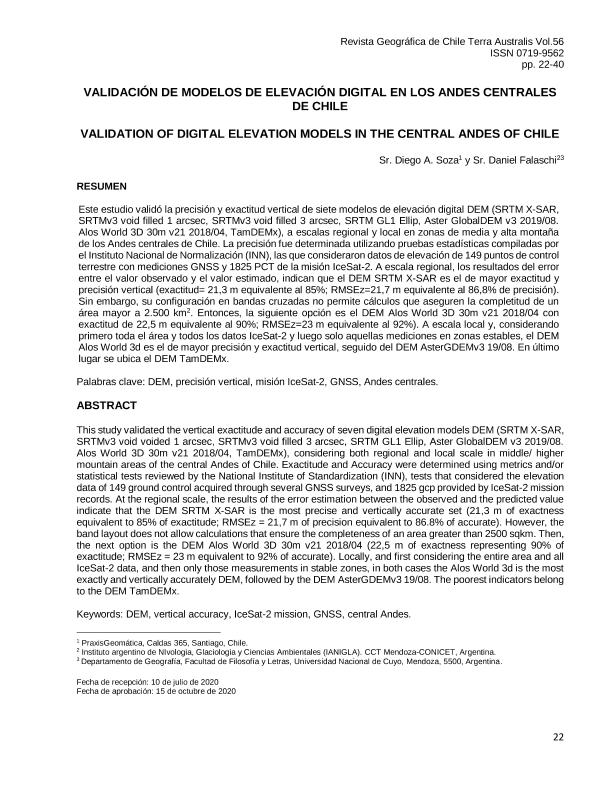
Este estudio validó la precisión y exactitud vertical de siete modelos de elevación digital DEM (SRTM X-SAR, SRTMv3 void filled 1 arcsec, SRTMv3 void filled 3 arcsec, SRTM GL1 Ellip, Aster GlobalDEM v3 2019/08. Alos World 3D 30m v21 2018/04, TamDEMx), a escalas regional y local en zonas de media y alta montaña de los Andes centrales de Chile. La precisión fue determinada utilizando pruebas estadísticas compiladas por el Instituto Nacional de Normalización (INN), las que consideraron datos de elevación de 149 puntos de control terrestre con mediciones GNSS y 1825 PCT de la misión IceSat-2. A escala regional, los resultados del error entre el valor observado y el valor estimado, indican que el DEM SRTM X-SAR es el de mayor exactitud y precisión vertical (exactitud= 21,3 m equivalente al 85%; RMSEz=21,7 m equivalente al 86,8% de precisión). Sin embargo, su configuración en bandas cruzadas no permite cálculos que aseguren la completitud de un área mayor a 2.500 km2 . Entonces, la siguiente opción es el DEM Alos World 3D 30m v21 2018/04 con exactitud de 22,5 m equivalente al 90%; RMSEz=23 m equivalente al 92%). A escala local y, considerando primero toda el área y todos los datos IceSat-2 y luego solo aquellas mediciones en zonas estables, el DEM Alos World 3d es el de mayor precisión y exactitud vertical, seguido del DEM AsterGDEMv3 19/08. En último lugar se ubica el DEM TamDEMx. This study validated the vertical exactitude and accuracy of seven digital elevation models DEM (SRTM X-SAR, SRTMv3 void voided 1 arcsec, SRTMv3 void filled 3 arcsec, SRTM GL1 Ellip, Aster GlobalDEM v3 2019/08. Alos World 3D 30m v21 2018/04, TamDEMx), considering both regional and local scale in middle/ higher mountain areas of the central Andes of Chile. Exactitude and Accuracy were determined using metrics and/or statistical tests reviewed by the National Institute of Standardization (INN), tests that considered the elevation data of 149 ground control acquired through several GNSS surveys, and 1825 gcp provided by IceSat-2 mission records. At the regional scale, the results of the error estimation between the observed and the predicted value indicate that the DEM SRTM X-SAR is the most precise and vertically accurate set (21,3 m of exactness equivalent to 85% of exactitude; RMSEz = 21,7 m of precision equivalent to 86.8% of accurate). However, the band layout does not allow calculations that ensure the completeness of an area greater than 2500 sqkm. Then, the next option is the DEM Alos World 3D 30m v21 2018/04 (22,5 m of exactness representing 90% of exactitude; RMSEz = 23 m equivalent to 92% of accurate). Locally, and first considering the entire area and all IceSat-2 data, and then only those measurements in stable zones, in both cases the Alos World 3d is the most exactly and vertically accurately DEM, followed by the DEM AsterGDEMv3 19/08. The poorest indicators belong to the DEM TamDEMx.
Validación de modelos de elevación digital en los andes centrales de Chile
Título:
Validation of digital elevation models in the Central Andes of Chile
Fecha de publicación:
12/2020
Editorial:
universidad Bernardo O’Higgins
Revista:
Terra Australis
ISSN:
0719-9562
e-ISSN:
0378-8482
Idioma:
Español
Tipo de recurso:
Artículo publicado
Clasificación temática:
Resumen
Palabras clave:
DEM
,
VERTICAL ACCURACY
,
ICESAT-2 MISSION
,
GNSS
,
CENTRAL ANDES
Archivos asociados
Licencia
Identificadores
Colecciones
Articulos(IANIGLA)
Articulos de INST. ARG. DE NIVOLOGIA, GLACIOLOGIA Y CS. AMBIENT
Articulos de INST. ARG. DE NIVOLOGIA, GLACIOLOGIA Y CS. AMBIENT
Citación
Soza, Diego A.; Falaschi, Daniel; Validación de modelos de elevación digital en los andes centrales de Chile; universidad Bernardo O’Higgins; Terra Australis; 56; 1; 12-2020; 22-40
Compartir
Altmétricas


